Alpe Foppa – Alpe Duragno – Monte Tamaro – Monte Gradiccioli – Passo d’Agario – Zottone – Forcola d’Arasio Sparavera – Alpe Tramboschino – Breno Gesamtstrecke: 18046 mMaximale Höhe: 1926 mGesamtanstieg: 920 mGesamtabstieg: -1669 mGesamtzeit: 05:38:07Download file: 2017-05-31-Tamaro-Breno.gpx
Berlincourt – Cote de la Chaux – Cote de Frenois – Le Cantonnement – Cote du Droit – Rouge Pertuis – Undervelier – Jolimont – La Cote au Pucin – Planches Frochais – Glovelier Gesamtstrecke: 18375 mMaximale Höhe: 1012 mGesamtanstieg: 1234 mGesamtabstieg: -1225 mGesamtzeit: 07:50:38Download file: 2017-05-30-Berlincourt.gpx
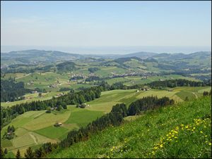
Zürchersmühle – Ranzberg – Hochchamm – Hofstettli – Bächli – Necker – St. Peterzell Gesamtstrecke: 12650 mMaximale Höhe: 1244 mGesamtanstieg: 582 mGesamtabstieg: -659 mGesamtzeit: 05:00:04Download file: 2017-05-28 Höchchamm.gpx
Netstal – Butzirus – Auerenalp – Auf den Schijen – Abendweid – Breitchamm – Länenegg – Raatlis – Hinter Klöntal Gesamtstrecke: 24796 mMaximale Höhe: 2069 mGesamtanstieg: 2177 mGesamtabstieg: -1780 mGesamtzeit: 08:07:50Download file: 2017-05-27-Klöntal.gpx
Les Pleiades – Passerelle Fegire – Lac de Joncs – Le Pralet – Col de Lys – Chenau – Orgevalette – Les Sciernes d’Albeuve Gesamtstrecke: 21392 mMaximale Höhe: 1832 mGesamtanstieg: 1130 mGesamtabstieg: -1581 mGesamtzeit: 06:38:18Download file: 2017-05-25 Col de Lys.gpx
Haute-Ajoie – Les Grottes de Reclere – Roche-d’Or – Vacherie Dessus – Gros Buisson – Col de Montvoie – Les Chainions – Col de la Croix – Outremont – St-Ursanne Gesamtstrecke: 26309 mMaximale Höhe: 928 mGesamtanstieg: 775 mGesamtabstieg: -930 mGesamtzeit: 07:41:47Download file: 2017-05-24 Haute-Ajoie.gpx